


MAPPING AND CHARTING FOR OVER 20 YEARS WITH HIGHLY QUALIFIED CATEGORY-A IHO STANDARD TRAINED STAFF THAT SUPPORTS FEDERAL AND LOCAL GOVERNMENT AGENCIES.
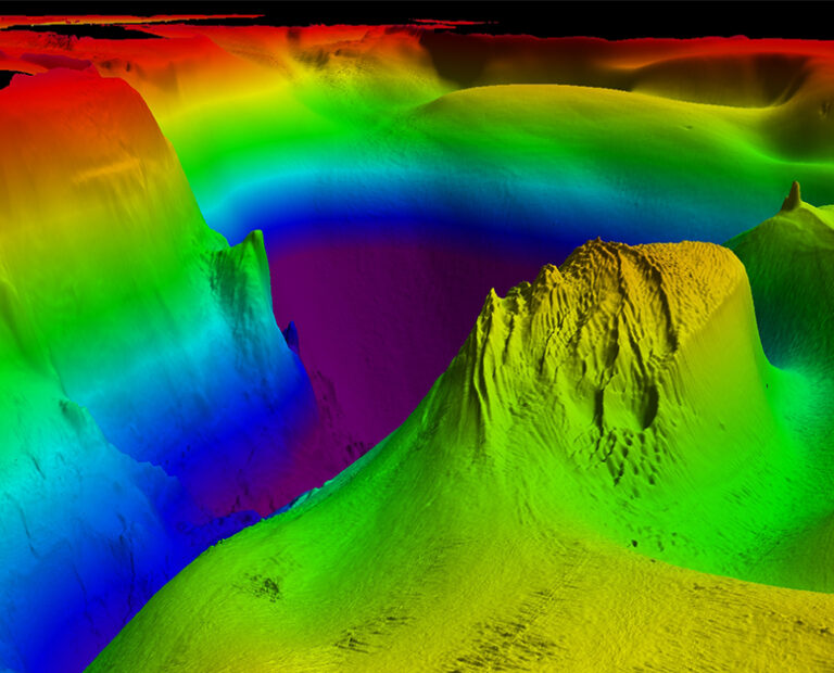
Acteon’s experience and expertise lead the industry in both data acquisition and processing of seafloor mapping information within all industry sectors. The notable approach in providing this critically important data is collaboration. We prefer to partner with you to assess your project and provide the best fit-for-purpose solutions to ensure all requirements are met safely, efficiently and within budget.
Services provided:
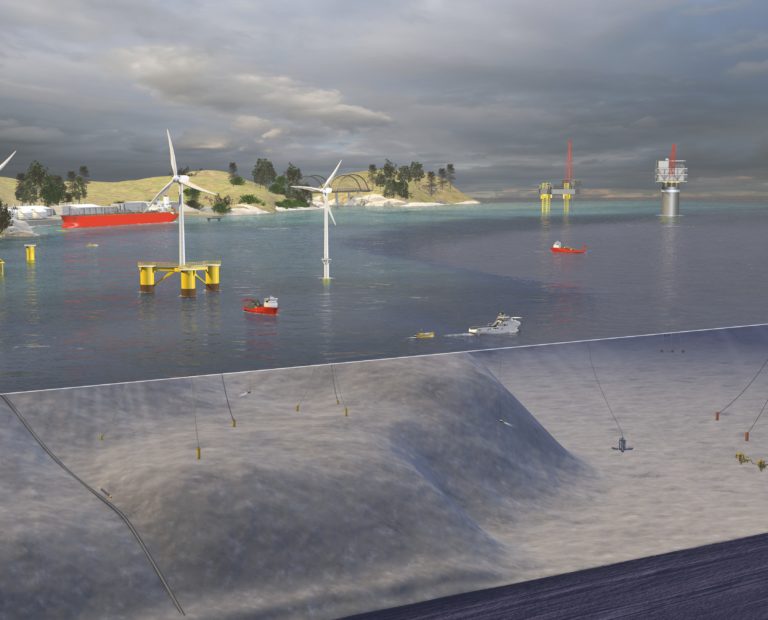
Airborne LiDAR bathymetry, beach erosion surveys, breakwater surveys, bridge and dam scour surveys, dredge volume computations, electronic navigation chart (ENC) generation, fisheries habitat mapping, floodplain mapping, harbour and channel condition surveys, hazard site assessment surveys, heritage preservation surveys, ice scour surveys, landing site surveys, levee condition surveys, locks and dam surveys, nautical charting, port and channel condition surveys, pre/post-excavation/dredge surveys, seafloor mapping, sediment transport studies, shallow hazard surveys, site clearance surveys, tidal and wave studies, tideland surveys, true nautical bottom surveys, GIS database, unexploded ordnance (UXO) detection.
Delivered by TerraSond
TerraSond specialises in collecting, compiling, and identifying geospatial and geophysical information that provides the best possible solution offering the lowest risk for customers in energy markets.

Integrate this product
Acteon can also offer an integrated project management service. This involves managing the activities of one or more of our companies on a customer’s behalf and providing a single point of contact for all aspects of project management.
GEO-SERVICES BROCHURE
Discover more about our solutions to real customer challenges and explore our full range of services to help you achieve project efficiencies.
Similar products and services
-
Desktop studies are conducted during the Front-End Engineering Design (FEED) phase of...
-
We efficiently collect data, conduct analysis, and report for Alarp UXO certification to...
-
Ground-penetrating radar provides the critical subsurface information of soil structure...
-
Our metocean equipment and survey services are fully integrated to support projects in...